Flood Monitoring for Coastal Resilience
(Updated February 2026)
Resilience refers to a community’s ability to recover from any damaging event, including severe weather events. “Coastal Resilience” captures the ability to recover from things like hurricanes as well as more chronic challenges like sea-level rise induced by climate change. Both hurricanes and sea-level rise are contributing to roadway flooding in coastal communities throughout the world, and the ability of a community to grapple with flooding is becoming one of the most important hallmarks of its coastal resilience.
In case you think that flooding is mainly an economic hazard due to the destruction of homes and businesses, and a mere inconvenience for drivers, flooding claims lives in the U.S. every year, and in some years hundreds of lives.
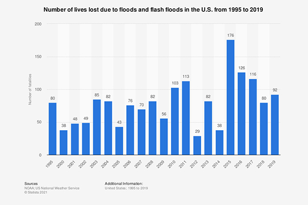
Source: Statista 2021
Further, roadway flooding is even more dangerous. According to the National Weather Service, flooding is second only to summer heat as a cause of weather-related deaths in the U.S., and deaths during floods are most often of people trapped in vehicles.
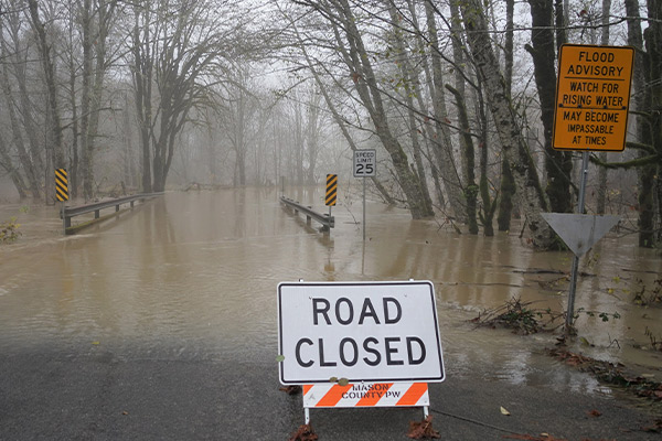
Along the Eastern seaboard of the U.S. one coastal community was experiencing storm-induced flooding events that were crippling the city with an ever-increasing frequency starting in the early 2010s. Residents fleeing the city during severe storms could find themselves trapped in traffic jams on flooded roadways as water levels rose, with no clear direction about alternative routes or how they might evacuate faster and most safely.
This community decided to take control and position itself for Coastal Resilience. They did this by putting out an RFI (Request for Information) to learn more about what technologies and solutions were available to monitor the flooding of their roadways. City officials and scientific consultants thoroughly evaluated the RFI responses, which eventually led them to choose the YSI team’s proposal: a network of roadway monitoring systems that combine water level sensors and telemetry for a real-time alert system. The alerts would not only be directed at city managers, but also to news stations and mobile apps that drivers could access directly from their phones.
A Tale of Two Sensors: Contact Versus Non-Contact Water Level Sensors
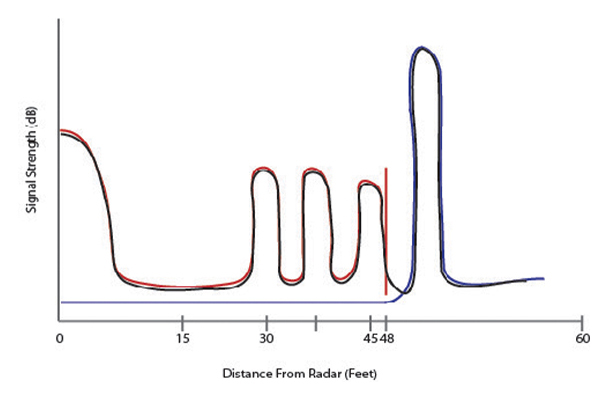
Each roadway monitoring installation proposed by YSI for this project would use one of two types of water-level sensors: radar or a vented pressure transducer. Vented level pressure transducers are ideal for shallow water applications, especially where storm scenarios are at play. Venting compensates for barometric pressure changes, which is critical when monitoring flood conditions.
For our roadway flooding project, we clearly will have shallow water and storm conditions, so vented pressure transducers were a great fit. So why aren’t we using vented pressure transducers at all of the stations? This question points to an interesting trend in the last 10 years or so, towards “non-contact” sensors, exemplified in this blog by YSI’s Nile Radar Sensor.
Some of the monitoring installations in this community would be over actual roads, not just nearby in ditches or stormwater drains. A “contact” sensor like a pressure transducer, with its long cable from the sensor to the logging and telemetry box, cannot be placed on roads, or even near roads, without being damaged or causing a hazard to drivers. Radar is also an excellent option when water may not always be present, or the sensor cannot be placed in the water due to other hazards (like cars!).
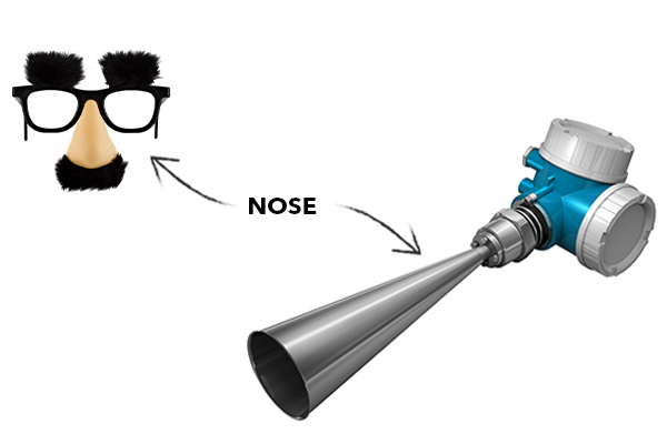
Radar sensors will be placed on existing structures like bridges and culverts for this project, over waterways prone to flooding. The radar may seem “exposed” to the elements, but Nile radars are ruggedized for almost any environment and can be bracketed within a NEMA enclosure with their “nose” sticking out. (Yes, 'nose' isn't a technical term, but it's descriptive).
There are other advantages to non-contact water level sensors like the Nile. Non-contact sensors can’t be washed away by fast-flowing water and may be harder to reach by vandals when secured properly because they’re not at ground level. Importantly, they are not prone to biofouling or getting covered up by debris, common occurrences that can render contact sensors nonfunctional.
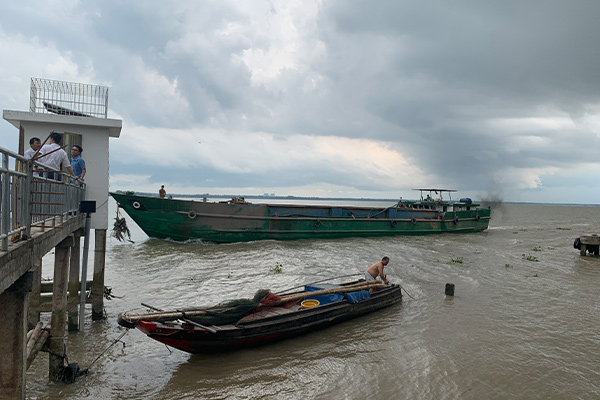
Non-contact level sensors are also very popular when tides are at play, such as in this fascinating flood monitoring project our team did in Terrebonne Parish in Louisiana. Our team in the Asia Pacific region briefly described use of the Nile by the Central Weather Bureau of Taiwan for tide monitoring, as another example. Last but not least, the Nile is also used by NOAA in the U.S. (as outlined in NOAA’s Recent Development and Test of Scalable Water Level Measurement Systems), and in fact, one of the features that make the Nile popular is a set of measurement modes we specifically developed for NOAA, but which are used worldwide, as outlined in the Mekong Delta project carried out by our Asia Pacific team.
In sum, here’s how I see it: Ultrasonics are fine for industrial applications like being used in tanks and solid structures, and for “stable” applications outdoors, but radar is usually a better choice for outdoor environmental applications where things can change drastically. I’m sure not everyone will agree with that assessment and it is a bit of an oversimplification, admittedly. But look closely at what your objectives are before choosing something simply on the basis of price.
Finally, an advantage of non-contact sensors is that they are not affected by changes in barometric pressure or water density (salinity), both important considerations for pressure transducers. Non-contact transducers also don’t require a desiccant and aren’t really affected if you change the position of the radar.
Sooo…if radars are so awesome, then why use the pressure transducers (PTs) at all for our roadway monitoring project? Well, a major reason —you may have already guessed it—is cost.
There are PTs that, even if not very accurate, are often good enough for the task at hand and which can cost about half of a radar (maybe even less if non-vented). Sometimes knowing the water level within 2-3 mm just isn’t necessary. So for this specific project radar was used when a PT wouldn’t work because of the environment, but not necessarily because of a big advantage with respect to accuracy or precision of the measurement. Similarly, the SonTek IQ excels in stormwater NPDES monitoring applications - it’s not that it’s the best water level sensor for all things, but it’s definitely the best combination of water level and flow monitoring available and was ideal for the NPDES compliance task at hand.
There are countless options for measuring water level; YSI sells other water level sensors not featured in this blog series. In the end, though, there isn’t a “best” water level sensor. The choice must first be driven by the application, and then by other considerations like budget, compatibility with loggers or power systems, and ease of use.
Returning to the road flooding case study, I want to digress from talking about water level to mention an exciting idea we proposed for this specific project, and which could be a real breakthrough for a community’s coastal resilience.
Delivering Road Flood Monitoring Data Directly to Drivers
Every water level sensor in this project is integrated with a low-power, low-maintenance, and robust telemetry solution that can withstand harsh weather conditions and is tamper-resistant for monitoring sites that are easily accessed by the public. The YSI team leveraged the wide-area availability of LTE Cellular networks since reliability was critically important.
Speaking of reliability, it was also critical that this monitoring system continues to work in the likely event of a power outage. Each compact, low-profile telemetry system is powered by low-cost replaceable batteries that could provide up to 3.5 years of service, eliminating the need for an easily vandalized solar panel. This complete hardware solution will be installed by YSI’s ISS team throughout this city.
A unique platform is being designed by YSI’s parent company, Xylem, which integrates the data with hydraulic and hydrological models to deliver not just numbers, but insights into flooding dynamics during a storm event. Roadway water level data will always be visible on public websites, with real-time maps, graphs, and historic data presentation options, as well as indicators for current flooding conditions (high/medium/low). The system is capable of sending emails, text alerts, and an RSS feed based on user-defined rules. The RSS feed, for example, heads straight to news outlets that can keep the community apprised of flooded roads.
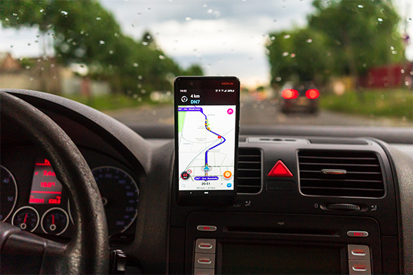
Perhaps most exciting for the residents and stakeholders is that data will also be distributed to Google Waze using FEMA IPAWS, the industry-standard data format for real-time route guidance. There is some work to do to make this possible; all data formatting will be handled by the Xylem platform so that data are seamlessly integrated into WAZE.
Lastly, this complete solution wasn’t just designed, but will also be built and operated by Xylem, with full transparency and flexibility so that the client can be as involved, or as hands-off, as they desire. Additionally, this community already had YSI’s EXO water quality sondes in place, and those data may be utilized by the Xylem platform in the future. In other words, this system is every bit as adaptable and resilient as the community it was designed to serve!