Big Questions Drive Research on Small Georgia Island
Tiny Island, Big Insights

YSI's Kevin Labbé (left) and University of Georgia researcher Katie Lamp'l set a course for data collection.
It Seems Everything About Little St. Simons Island is Unique
As many barrier islands around the world are eroding away, Little St. Simons is growing, thanks to sediment deposited by the Altamaha River along its northern edge. While most of the Sea Islands up and down the southeastern U.S.'s Atlantic coast have been broken up and densely developed, Little St. Simons has been a single parcel since the late 1700s.
Today, the island hosts just 32 overnight guests on a busy night in its sole eco-lodge—along with countless birds, fish, crustaceans, and plenty of alligators.
And in a nation where bird habitat is shrinking, Little St. Simons Island and neighboring Georgia barrier islands received the highest designation, Landscape of Hemispheric Importance, from the Western Hemisphere Shorebird Reserve Network.
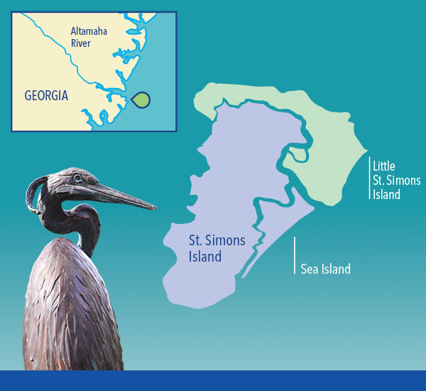
Unlike other barrier islands in the Southeast, Little St. Simons Island was never cleared for agriculture.
At just 11,000 acres, Little St. Simons Island is a tiny squiggle on most maps. But its subtle uplands—just 10 to 12 feet above sea level at best—and sprawling wetlands present a big opportunity to study
coastal dynamics.
A considerable portion of the island is a relatively pristine marsh, while another significant section right next to it is a marsh that was ditched and channelized in an attempt to increase water flow and control mosquitoes starting in the 1930s.
Unique Comparisons
The ability to compare the dynamics of altered and unaltered marsh has drawn a team of researchers from the University of Georgia. Ecologist Lori Sutter (@MarshMucker) is working to determine whether the marshes are sources or sinks of nitrate, nitrite, ammonium, total nitrogen, orthophosphate, and sediment.
Meanwhile, Susan Bennett Wilde, an expert in algae and cyanobacteria, and graduate student Katie Lamp'l are investigating the ebb and flow of algae during tidal cycles, and exploring how that dynamic corresponds to nutrients flowing in and out of the marsh on the tides.
Research professional Wesley Gerrin helps calibrate, operate and troubleshoot a suite of sophisticated instruments and process massive amounts of data. Ultimately, they're trying to understand the most basic movements of water and unicellular organisms in the system. Sutter hopes to determine whether nutrients collect in tidal wetlands like Little St. Simons as the tides come in.
She is also testing whether hydrogeomorphic (HGM) tools used by the U.S. Army Corps of Engineers to identify and manage marshes on the typically calm Gulf Coast can be applied to Georgia's Sea Islands, where tides are measured in feet instead of inches.
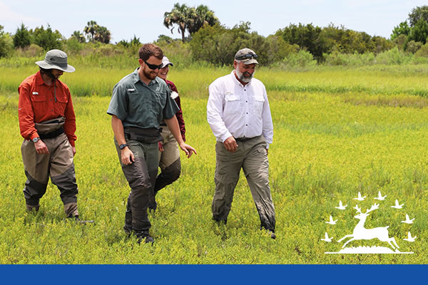
The 11,000-acre island offers huge research opportunities.
Rather than classifying wetlands by their surface structure, hydrogeomorphic tools categorize them by assessing their topographic location, likely biological function, water source and transport, and the strength and direction of flow.
"Is this HGM methodology useful in Georgia or not?" asks Sutter. "Are we able to discern the difference between altered and reference marshes using it?"
If so, the Corps' hydrogeomorphic methods can be used on an Atlantic barrier island like Little St. Simons to assess wetland function based on the indicators a regulator might observe during a field visit.
Wilde and Lamp'l hope to better understand the dynamics of algal blooms in tidal marshes. That knowledge could help the conservation team at The Lodge on Little St. Simons Island manage the stretch of marsh known as Myrtle Pond to minimize the risk of harmful algal blooms (HABs) that could threaten wildlife. It could also guide other land managers in
the region as they face similar challenges.
Rare Preserve
Unlike most of the Sea Islands along the stretch of Atlantic coast between North Carolina and north Florida, Little St. Simons Island was never cleared for agriculture like so many of the barrier islands in the Southeast.
The island's antebellum owner used the land to raise livestock. Over the years, the property was largely left as a feeding ground for at least 300 species of birds, many of which stop there along their seasonal migration to gorge on fiddler crabs and other wildlife.
In 1908, Philip Berolzheimer of the Eagle Pencil Company bought the island in hopes of harvesting its cedar trees to make pencils.
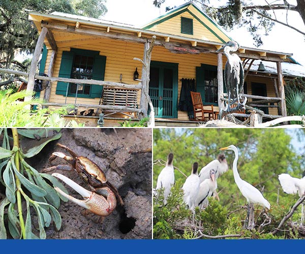
The Lodge on Little St. Simons Island (top) welcomes up to 32 visitors at a time. Local fauna (bottom), fiddler crabs and their natural predators.
But the constant coastal wind had gnarled the trees, making them unsuitable for Berolzheimer's plans. Within a few years, the island became a family retreat, and in 1979, Berolzheimer's descendants opened their family's compound as a lodge.
More than 20 years later, former lodge guests Hank and Wendy Paulson bought the property, and in 2007 hired a full-time ecological manager.
In 2015, the Paulsons secured the island's future as a preserve by donating a conservation easement to The Nature Conservancy.
Subtle but Significant
Tides flow in. Tides flow out.
It seems simple enough, but the UGA team's research on Little St. Simons Island is full of mysteries and nuance. The altered marsh has a single opening through which water enters and exits the wetland, and is crossed by straightened "mosquito ditches" to speed water flow in and out of the parcel in an effort to reduce mosquito breeding.
The comparison wetland, the "reference" marsh, has more natural, sinuous channels. The reference marsh is complicated by the fact that it has a main portal on the north side and a smaller inlet on the south side that could play an important role in the movement of water and nutrients, Sutter notes.
"That's the hole in the bucket; the back door," she says.
Comparing the altered marsh with the reference marsh could provide valuable insights into the role of hydrological modification—for instance, the straightened ditches that are common in the region.
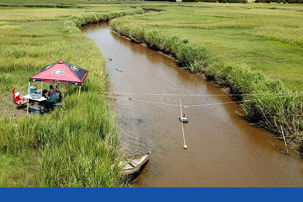
Running transects with the RS5 gives the team a bigger picture of narrow tidal creeks.
"Can we discern any difference between the altered and reference sites?" Sutter asks. "Are these creeksheds serving as sources or sinks of particular nutrients or sediment?"
Answering those questions demands highly accurate and adaptable instruments, capable of precise measurements even in extremely shallow water.
The difference between low and high tide in the marshes on Little St. Simons Island is about 5 feet (1.5 meters) on an average day, raising the water depth in the tidal channel for about three hours, then draining again for about nine hours. From the perspective of measuring water volume and current, that's a challenging range.
Complicating the issue further are the narrow tidal creeks—which drain completely on some occasions and continue flowing on others—and the fact that the water experiences bidirectional flow during the tidal cycle.
“The Little Rock Star”
The University of Georgia team developed a grueling sampling and profiling protocol that called for them to measure discharge and a host of water quality parameters almost constantly through complete tidal cycles.
That meant heading out to the study site before dawn, loaded down with equipment, paddling down sloughs and slogging through mud and vegetation to the testing sites, setting up the equipment and what Sutter calls "a gajillion bottles," and gathering data almost constantly for 12 to 14 hours at a time.
And fighting mosquitoes.
And watching for alligators.
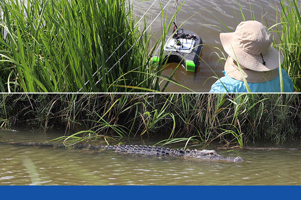
UGA's Susan Wilde deploying the RS5 in reptile-friendly conditions.
They repeated the process once each season, with all the challenges of COVID thrown on top, in 2020 and 2021. "If it was easy, it would have been done already," Lamp'l points out.
The centerpiece of the team's testing instruments is the SonTek RS5, the world's smallest acoustic Doppler current profiler (ADCP), mounted on a HydroBoard II Micro hull. Innovative beam switching capabilities allow the RS5 to gather accurate velocity data just inches away from the bank—far closer than other ADCPs can.
"You can measure a higher percentage of the stream than you would be able to with any other device," notes Kevin Labbé, the Xylem application specialist who trained the UGA team on its use and joined the group for the data collection on Little St. Simons Island.
To learn more, watch Day in the Life of a Hydrographer with Kevin Labbe which highlights this story.
Every 15 minutes, the team conducted a transect of the marsh inlet with the ADCP, pulling it easily across the channels on its little hydroboard, tracking the movement of the tides, and calculating tidal discharge (Q) in fine detail.
In fact, Lamp'l points out that the RS5 typically kicked off each study day's protocol by precisely indicating—to three decimal places—when the tide was turning, something that couldn't be accurately ascertained by observing the water's surface.
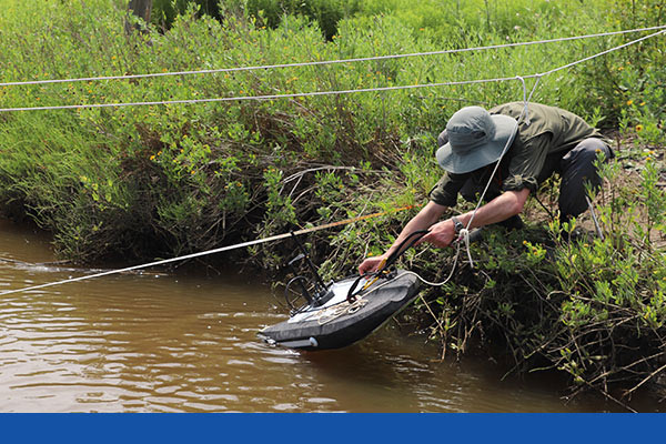
The SonTek RS5 can gather accurate velocity data just inches away from the bank.
In all, the RS5 is subject to a schedule as grueling as the research team, Labbé points out.
"Usually, you go service a gauge, calibrate it, then take a discharge measurement and go to the next site, so most ADCPs really only run maybe 2 or 3 percent of the day," he explains. "At Little St. Simons Island, that RS5 is on for 12 hours a day. They're really pushing the boundary of normal data collection. The amount of data they collect in a day is like what other people might gather in a year." Wilde calls the RS5 "the little rock star."
"The size of it is brilliant," she says. "You could carry it to a tiny creek and use it in really shallow water. I don't know of any other system that can do that."

Instant Data
Lamp'l adds that the RS5 is not only convenient to carry to a study location in its compact backpack—no small advantage on a roadless island that's only accessible by ferry—it's also convenient to use.
"A towable ADCP like the RS5 is easier than using a handheld FlowTracker to measure discharge because with a handheld FlowTracker, you need to physically get in the water and determine a stream cross-section by measuring stream width, water depth, and velocity at equal subsections.
"For our project, it would have been extremely difficult to use a FlowTracker to accurately measure discharge every 15 minutes for a full tidal cycle (from one low tide to the next) in a saltmarsh tidal creek with soft, muddy substrate, oyster beds, tidal ranges, wrack—and you can't forget about the alligators," Lamp'l says.
One of the datasets Wilde and Lamp'l are most excited about is the ratio of tidal volume compared to algae concentrations. They used the chlorophyll a sensor in a YSI EXO3 Multiparameter Sonde to estimate the volume of algae in the sample.
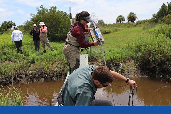
Katie Lamp’l and Wesley Gerrin deploy an EXO3 sonde to collect minute-by-minute data on water quality throughout the tidal cycle.
Early in the project, the team put the EXO3 to the test against its lab equipment, performing linear regressions to compare the in-situ chlorophyll a data against bench analysis equipment.
"We saw that the relationship is strong—R2 0.8—so we trust the data from the sensor," Lamp'l says.
A phycocyanin sensor on the same sonde helped the team determine whether a bloom is benign algae or potentially harmful cyanobacteria. The EXO3 sonde, set to sample every minute during the testing period, also measured conductivity/specific conductance, dissolved oxygen (DO), pH, and temperature.
The combination of instruments and high-resolution data created a unique package, Wilde notes.
"I think these tools are valuable in a lot of systems where we have to understand the hydrology and nutrient flux and then what is the algal response to it," she says. "I would see this as a way where we could get a lot more data on tidal flow and how nutrient/sediment exchange affects water quality on barrier islands."
Marsh Health
At The Lodge on Little St. Simons Island, staff ecological manager Scott Coleman says the data Sutter, Wilde, and Lamp'l are analyzing will be extremely valuable to him and his staff as they manage the property.
"We'd like for it to be healthier than it is," Coleman says. "But without having all the data, it's hard to say what steps we should take.
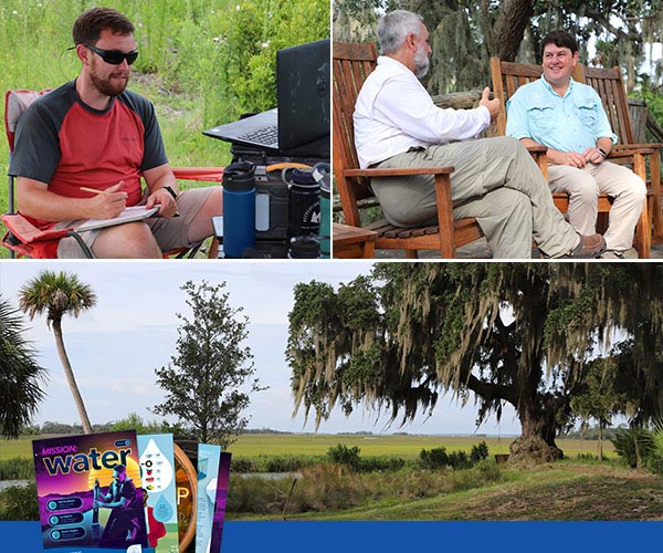
Wesley Gerrin (top left) combines old and new data logging techniques in the field. Scott Coleman (top right), staff ecological manager for The Lodge on Little St. Simons Island, discusses the research project with YSI's Kevin Labbé.
"The idea is that this will be the final piece of research—how the marsh is functioning, how healthy the marsh is. And we're hoping this methodology can be applied in different sites along the coast."
After a full year of quarterly visits to Little St. Simons Island and long days of almost constant measurement, Sutter is eager to see results that support models like the Army Corps' hydrogeomorphic tools.
"No one in their right minds would ever do this again," she laughs.
