EXO Bayou Sorrell
After Eight Months Underwater, EXO2 Sondes Deliver a Bonus: Accurate Data
(Updated November 2021)
Joe Baustian expected his YSI EXO2 sondes in the Bayou Sorrell network of South Louisiana to collect data hourly for an extended deployment. The Nature Conservancy (TNC) wetland ecologist just never imagined it would be extended so long.
“It was a deployment of about eight months,” said Baustian after more than two feet of spring rains in 2019 set records for flood-stage duration throughout the Mississippi River basin. “I was worried every second, every day, after three months.”
More than 200 days after their scheduled maintenance visit to the monitoring stations, Baustian and his team slogged and paddled their way through the twisted cypress-tupelo swamp forest along Bayou Sorrell and retrieved all seven of their YSI sondes. To his delight and amazement, six of the seven EXO2s were still collecting data.
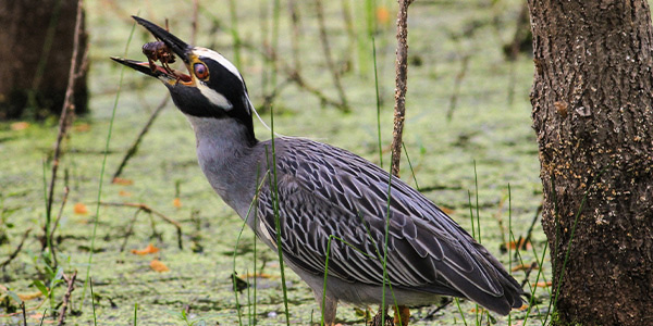
A yellow-crowned night heron enjoys a crawfish dinner in the Atchafalaya Basin. The 1.4-million acre system is home to more than 400 species of animals and plants. Photo Credit: Matt Pardue, TNC
Precious Wetland
Baustian's network of sondes monitors TNC's Atchafalaya Basin Preserve, a 5,359-acre property in the heart of the Atchafalaya Basin. Water from 31 U.S. states and two Canadian provinces—about one-third of the total flow of the Mississippi River—is flushed through the 1.4-million-acre Atchafalaya.
When the basin is healthy, it acts like a huge kidney, cleansing the Mississippi's flowing water of sediments and nutrients before they reach the sensitive aquatic spawning grounds at the coast. The basin's inland wetlands and forests are home to 300 species of wildlife above the surface and 100 aquatic species—including reptiles, amphibians and a wide array of fish—making them important biologically and commercially. And the shrinking stands of trees in the swamp forest blunt the force of floodwaters and storms, store carbon and represent a unique and shrinking ecosystem.
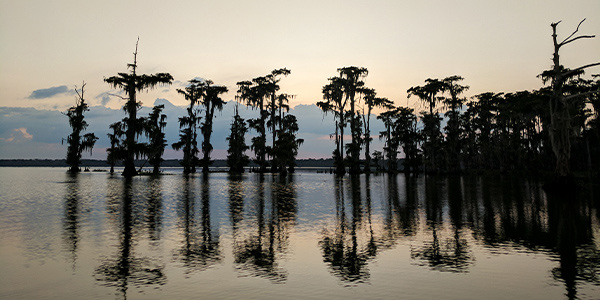
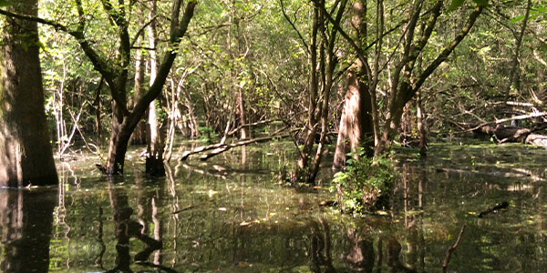
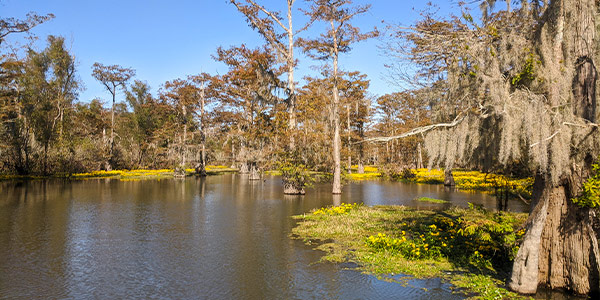
Beautiful and unique, the cypress-tupelo swamps in The Nature Conservancy’s Atchafalaya Basin Preserve are yielding insights that could help guide restoration of historic flows and habitats. Photo Credit: Joe Baustian, TNC
But the Atchafalaya's cleansing system is compromised, and so is the ebb and flow of seasonal water that nurtured the vast tangle of swamp forest for millennia. Over the past century, engineers and dredge crews pinned the Atchafalaya between high levees, deepening and straightening its channel to shunt floodwater safely around the ports of Baton Rouge and New Orleans.
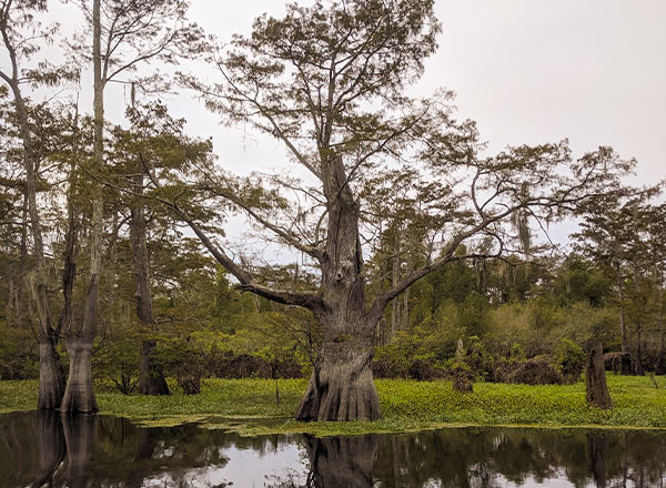
The cypress-tupelo swamps of The Nature Conservancy’s Atchafalaya Basin Preserve can serve as spawning grounds, sediment and nutrient filters, and buffers against storm flows from the Gulf. Photo Credit: Joe Baustian, TNC
Slow, meandering creeks called bayous were slashed by shipping channels and pipeline canals, their high berms ensuring that only water nearing the flood stage could even reach the swamps or drain out of them. Vast areas stagnated, turning bayous that once flowed brown with turbulent, aerated water into slack, black backwaters.
Trapped water-filled low areas with sediment. In some parts of the basin, the system was replumbed so drastically that the natural flow of the bayous was actually reversed.
That compromises the swamp forest as a habitat, a filter, and a buffer against the massive flow of water from upstream. The Nature Conservancy team believes it can reopen some of the Bayou Sorrell floodplain to medium-level flows that can nurture the system in normal years.
"We're finding those key areas where you can open up the bank, lower the elevation in key spots to let that water flow across those swamps like it used to, and allow water to interact with the floodplain at a more normal level than it does now," Baustian explained.
Breaking the barriers to seasonal water movement will allow oxygenated, flowing water to deliver a breath of fresh air to fish and crawfish in their muddy beds. It will allow cypress forests—just inches higher in elevation—to drain for a few months so seedlings can take root and rejuvenate native stands.
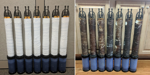
Biofouling is a constant challenge in the Atchafalaya Basin. While the automatic wiper on their EXO2 sondes keep sensors clean through long deployments, Joe Baustian and his team wrap the sondes’ bodies in plastic wrap and duct tape to keep them from becoming home to tenacious estuarine life. Photo Credit: Joe Baustian, TNC. [Read Blog Post: 7 Tips to Fight Fouling and Extend Water Quality Sonde Deployments]
Understanding the System
Understanding the movement of water in the Bayou Sorrell system, and its impact, requires data. But although the state of Louisiana and the U.S. Geological Survey have a large body of data on the Atchafalaya channel and the coastal wetlands of the system, there is very little information on the swamp forests.
"No one's ever taken continuous samples like this in the back-swamp habitats," Baustian said. "These environments have been severely under-gauged."
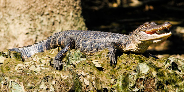
Deep mud, hidden roots, and mosquitoes—and alligators—have kept most scientists from studying the inland swamp forests of the Atchafalaya. Photo Credit: Matt Pardue, TNC
The Nature Conservancy developed a network of long-term, continuous monitoring stations around Bayou Sorrell to learn how its property functions and set the baselines to eventually chart the effects of the changes it will make in the system. Continuous monitoring provides a high-resolution view of the workings of the bayous and wetlands. It also makes data collection much safer and more pleasant in an environment where it quickly becomes obvious why few data resources already exist.
"You've got vines, shrubs, networks of branches," Baustian said. "You're moving so slow that GPS doesn't even know you're moving. The mosquitoes can get really bad. And, yes, there are alligators."
Long Intervals
To extend the interval between forays to the stations, Baustian chose EXO2 multiparameter sondes for the job because he has had a long history with YSI's instruments in his previous research in ocean, lake and river environments.
Running on four ordinary D-cell batteries, the EXO2 features seven universal smart ports. Each accepts any of an array of energy-efficient sensors that can be pre-calibrated and easily plugged into place in the field. That makes deployment and maintenance simple. Most years.
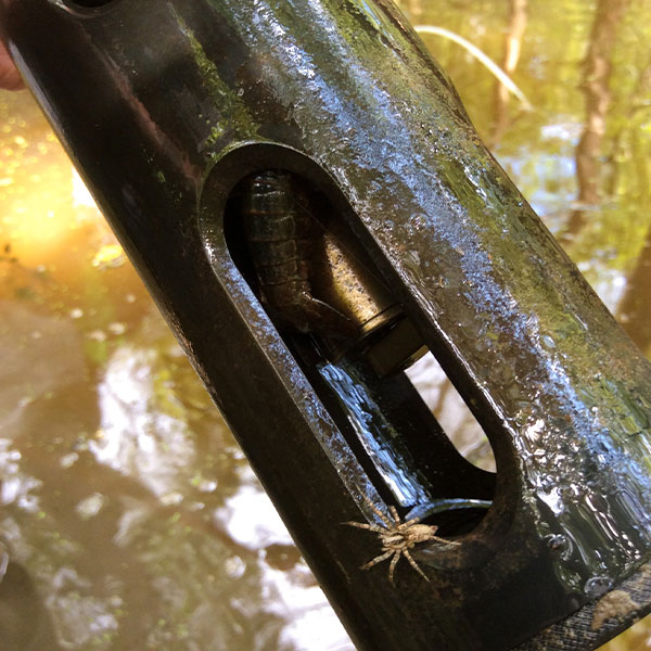
Crayfish like this one are just one form of the abundant swamp life attracted to the sondes. Baustian and his team wrap their sondes in plastic wrap and duct tape to minimize fouling of the bodies; the EXO2’s automatic wiper keeps sensors clean throughout their deployment.
"Typically, we'd go out every two to three months to change batteries, download data, and clean the sondes," he noted. "But with this year's flood, the water was nine feet deep. The EXOs were sitting on the bottom.
"For whatever reason, one had run out of batteries two months before the others. But the other six were still collecting data," Baustian marveled. "When I downloaded the data, not only did the stations have agreement with each other, they had agreement with other stations in the Atchafalaya Channel. The six sondes that were still collecting data were collecting good data."
Baustian had brought along a YSI ProDSS equipped with a dissolved oxygen (DO) sensor on the maintenance and recovery mission. There was strong agreement between the EXO2 data and the ProDSS data, even after the sondes spent eight months in the field. Baustian called that close correlation on DO the "lagniappe"—the local Cajun word for "bonus."
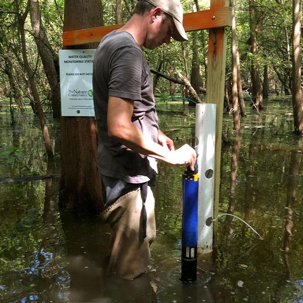
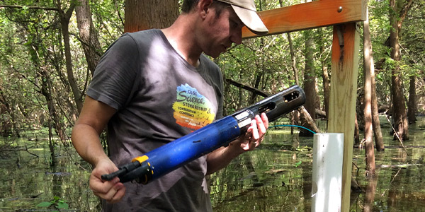
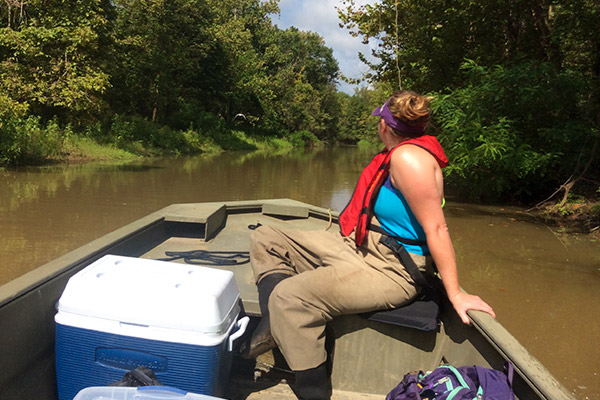
Joe Baustian of The Nature Conservancy deploys an EXO2 sonde in Louisiana’s Atchafalaya Basin. Water quality data from the Conservancy’s network of sondes is providing insight into the region’s little-studied swamp forest.
A Great Model
When wetland ecologist Joe Baustian of The Nature Conservancy (TNC) developed a network of long-term continuous water quality monitoring stations to assess the function of TNC's 5,359-acre Atchafalaya Basin Preserve and track the effects of planned restoration projects, his inspiration was just a short way downstream.
"The State of Louisiana's Coastal Protection and Restoration Authority has a system of reference sites along the coast," Baustian said. "We actually wanted to mimic their system, getting a long-term idea how the conditions are changing—historic data, current data. Is this swamp functioning like other swamps in the area? Is this year an anomaly for some reason?"
Baustian selected YSI EXO2 sondes for his seven-station network. He had worked with YSI sondes on the legs of massive oil rigs in the Gulf of Mexico. ("It was a much different context," he noted. "SCUBA diving to service them every month. Sixty feet underwater, barnacles and sharks.") He used YSI instruments again in his work in the rivers and wetlands on the edge of the Great Lakes.
"The sondes just work amazingly well," he said.
So far, Baustian and his team have collected four years' worth of data at Bayou Sorrell, and they plan to continue monitoring as the property undergoes restoration.
Hourly Measurements
In addition to measuring DO, TNC's EXO2s are equipped with sensors that measure water level, turbidity, specific conductance, and temperature. The center port of each sonde contains a rotating wiper that cleans the sensors twice an hour, keeping them clear of the biofouling that covers everything in the rich estuarine environment in a thick layer of brown and black muck. Each instrument is deployed in a perforated four-inch PVC pipe mounted to a fixed wooden frame.
The Nature Conservancy is conducting groundbreaking research in the swamp forests of Louisiana’s Atchafalaya Basin—and inadvertently put its EXO2 sondes through an extreme field test when record floods extended their deployment to eight months. Photo Credit: Joe Baustian, TNC
Hourly measurements allow Baustian and his colleagues to observe changes in water quality that would be impossible to spot with less-frequent sampling protocols. Diurnal cycles of productivity and flow appear in the data as repeating patterns. More dramatic spikes in dissolved oxygen across the network tracked 2017 flooding along Bayou Sorrel and Little Tensas Bayou, demonstrating the benefits of connecting the river to the back swamps—and highlighting how quickly water quality degraded after the connection was blocked again as the flood waters fell.
In 2019, a quick spike in conductivity and drop in DO and turbidity recorded a pulse of black water traveling past one of the sondes. Normally, it would have gone unnoticed. But the continuous monitoring system picked it up and Baustian and his team recognized it as a heartbeat, the flutter of a system coming back to life as once-stagnant black water joined the flow of the main artery. The kidneys may be struggling, but the basin's heart keeps beating.
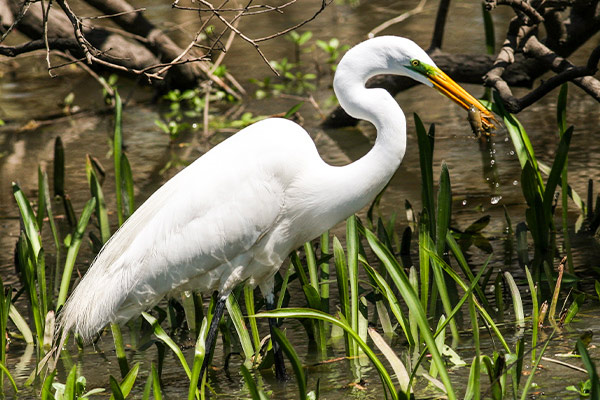
A great egret feeds on crawfish in the Atchafalaya Basin. Restoring water flows through the network of bayous and swamps will likely benefit a wide range of species in the highly disturbed environment north of the Gulf of Mexico.Photo Credit: Matt Pardue, TNC
Give Us Hope
Baustian noted that the pulses of water mixing across boundaries that have been unpassable for decades shows the great potential of repairing the swamp forest ecosystem.
"This is an analogue of what will happen with restoration," he notes. "Everything's making sense with what you'd expect ecologically. These data give us hope that the restoration will be good for the aquatic ecosystem.
"If we can show and document how much the benefit is and how great it works, maybe we can get more people to buy into the concept."
At YSI, product manager Stephanie Smith (@WaterWoman) points out that Baustian is pushing not only his sondes but the frontier of wetland science.
"Joe and his team have deployed the EXO2 in a remarkably challenging environment, with biofouling about as bad as it can possibly be and—because of the flooding—for nearly three times the rated battery life," Smith said. "That is very exciting for us as a manufacturer to see. But equally exciting is seeing that the data TNC is gathering is shining a light on an ecosystem that has been in the shadows, despite the fact that it is so important to the continent and to the planet."
Baustian is modest about the fortitude it takes to work in the swamp forest. But his enthusiasm for bringing the area's workings to light—and creating an opportunity to demonstrate how broken systems can be restored—shines through.
"We're really excited," he said. "Every time we collect data, it's something it’ something new. It’s exciting when we get data because it’s always pioneering in some aspect.”

Additional Blog Posts of Interest
Networks That Work | NarragansettBay Fixed-Site Water Quality Monitoring Network
How to Disinfect Your Field Water Quality Equipment
Store Your Water Quality Instrumentation Properly
For the Love of Charles | A River on the Rebound