Continuous Monitoring Provides Vital Water Usage Information
Arid West Threatens Development
During his exploration in 1860, John Wesley Powell, a U.S. soldier and geologist, recognized that the arid west was not sustainable for extensive development. Despite his warnings, many saw the economic potential and moved west anyways. Farming and population growth were made possible by damming western rivers to support massive irrigation projects.
Newlands Act Passed in Hopes to Stimulate Settlement
Years later, the irrigation projects showed success in the aid of local farmers, however, it became apparent that more help was needed. Francis G. Newlands, of Nevada, sought help from the United States legislature on the irrigation projects. The resulting Newlands act was passed in 1902, as one of the first reclamation projects in the United States to stimulate settlement in the West.
Construction on the Derby Dam was initiated in 1903 on the Truckee River located northeast of Reno, Nevada. The Dam would assist in diverting water from the Truckee River, to be used in irrigation. In 1927, Truckee-Carson Irrigation District (TCID), a political subdivision of the State of Nevada that was organized for the purpose of representing the water rights holders within the boundaries of the Newlands Project, took over the maintenance and operation of the Newlands Project by contract with the United States.
“Since then, the District has been responsible for the operation and maintenance of the entire federal project which includes the dam at Lake Tahoe, Derby Dam, the Truckee Canal, Lahontan Dam, and approximately 380 miles of canals and 345 miles of drains,” stated Truckee-Carson officials. “During a normal water year, the District delivers water to about 2,500 water users and delivers approximately 200,000-acre feet of water primarily for agricultural use”.

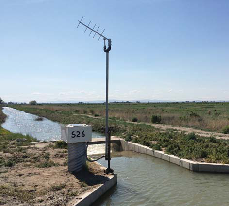
YSI Storm 3 data logger and GOES telemetry paired with a SonTek-SL sensor allows the monitoring data to be viewed 24/7 without travel to the site. This is essential to continuous resource management, understanding and eliminates costly field visits.
Water Management is Vital
It is essential to monitor water flow in the Truckee-Carson Irrigation District for a number of reasons—a couple being environmental impact and public safety.
“Without water and the effective management of this vital resource, the arid west would be, at best, a vast area of largely uninhabited space” comments Walter Winder, former Deputy District Manager, and current owner of Winder Land and Cattle. Continuous water monitoring sensors installed at the Truckee Canal provide important data needed to make deliveries for various types of economic activity to the area, including but not limited to, irrigation for agriculture.
“It is impossible to make deliveries to multiple water users at the same time without knowing the amount and location of the water within the system,” Winder continues. “And in a gravity-controlled, open-channel system [like the Truckee Canal] that requires even greater care and monitoring than others, having the correct volume (cubic feet or acre feet), bay level (stage), and timing to make deliveries is an extremely delicate process”.
Having accurate bay level monitoring and automation is critical to make certain that the highest water level anticipated is not exceeded, causing overtopping and embankment failure issues.
Backwater (gradually varied) Conditions
The monitoring of accurate and reliable flow data is dependent on good site selection and measurement methodology. Over the years a number of flow measurement structures and instrumentation has been implemented to monitor flows and to provide warning during canal overtopping. Officials have recognized the impact of backwater conditions on the measurement accuracy of flow measurement structures especially due to high water demand and change channel conditions.
In years past, Repogle flumes (flow measurement structures) have been widely used as an effective tool for the TCID. In monitoring sites not suitable for flow measurement structures due to site conditions or where the backwater effects will exceed the design criteria, another measurement alternative is required.
Side-Looker Solution
Through trial and error, the use of up-looker and down-looker technology proved ineffective in open-channel scenarios. The SonTek-SL sensor (Acoustic Doppler technology) provides an accurate solution where gradually varied (backwater) flows exist at monitoring sites.
The SonTek-SL measures the water velocity in real-time with the stage and this makes the instrument ideal for applications where traditional flow measurement structures or other instrumentation is not capable of measuring accurately. The total volume is calculated using the velocity and stage measurement performed by the SonTek-SL with a user-defined cross-section that is entered in the instrument.
To serve the demands and accurately measure a wide variety of flows ordered by water users, the TCID needed to come up with a solution to locate the sensor head in a way that met the placement requirements in the channel cross section. The SonTek-SL was installed at a specific height above the channel bed to optimize the measuring range and to prevent any sediment build-up affecting the measurement accuracy.
Real-Time Data
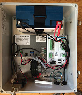
The sites also use YSI Storm 3 data loggers and GOES satellite technology, to push the data to the data hosting solution allowing officials to access live monitoring data anytime online (saving them a trip out to the site), and process water delivery data.

Storm 3 data logger with GOES satellite technology
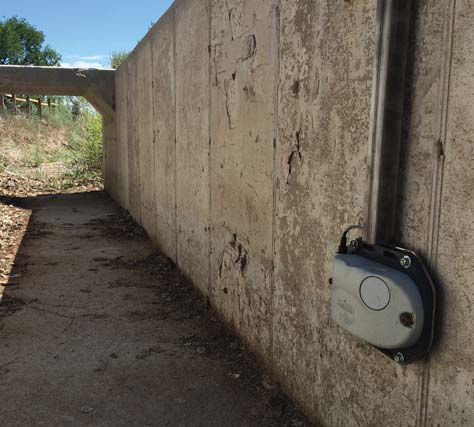
Side-Looker Installed in the Truckee Canal
“Accounting for the water delivered to the users in an accurate and timely manner is critical to the successful use of water during the season,” explains Winder.
“More than 700 miles of delivery system through areas of limited access and (in most cases) no electrical service, along with unreliable radio signal make for a set of problems all their own. Use of the GOES satellite technology with side-looker instruments has greatly improved these issues. The collection, transmission and distribution of the collected data can be done in minutes rather than days or weeks.”

SonTek-SL installed in the Truckee Canal

Additional Blog Posts of Interest
Sea Level Rise Research: Clam Bayou Estuary Florida
The Evolution of Water Quality Monitoring [Free eBook]
How Does Real-Time Data Save You Time?
Trouble Collecting Data with Your Water Quality Sonde? Try This!